
3.037 ALL c1850 PLA BHM 726 B11
Land in occupation of Joshua Robertshaw (owner late John Cowgill)
Material: cartridge paper Scale: 2 chains per inch Size: 60*34 cm Condition: poor
Unusually this item consists of two plans of the same property on the obverse and reverse sides. The reverse is entitled ‘146 A – Plan of property at Allerton belonging to late John Cowgill’. There is a scale bar provided but no date or other identification of any kind. The obverse shows a more detailed ink plan illustrating the same land but on a different scale. It includes a reference list of the buildings and field names which are described as being in the occupation of Joshua Robertshaw.
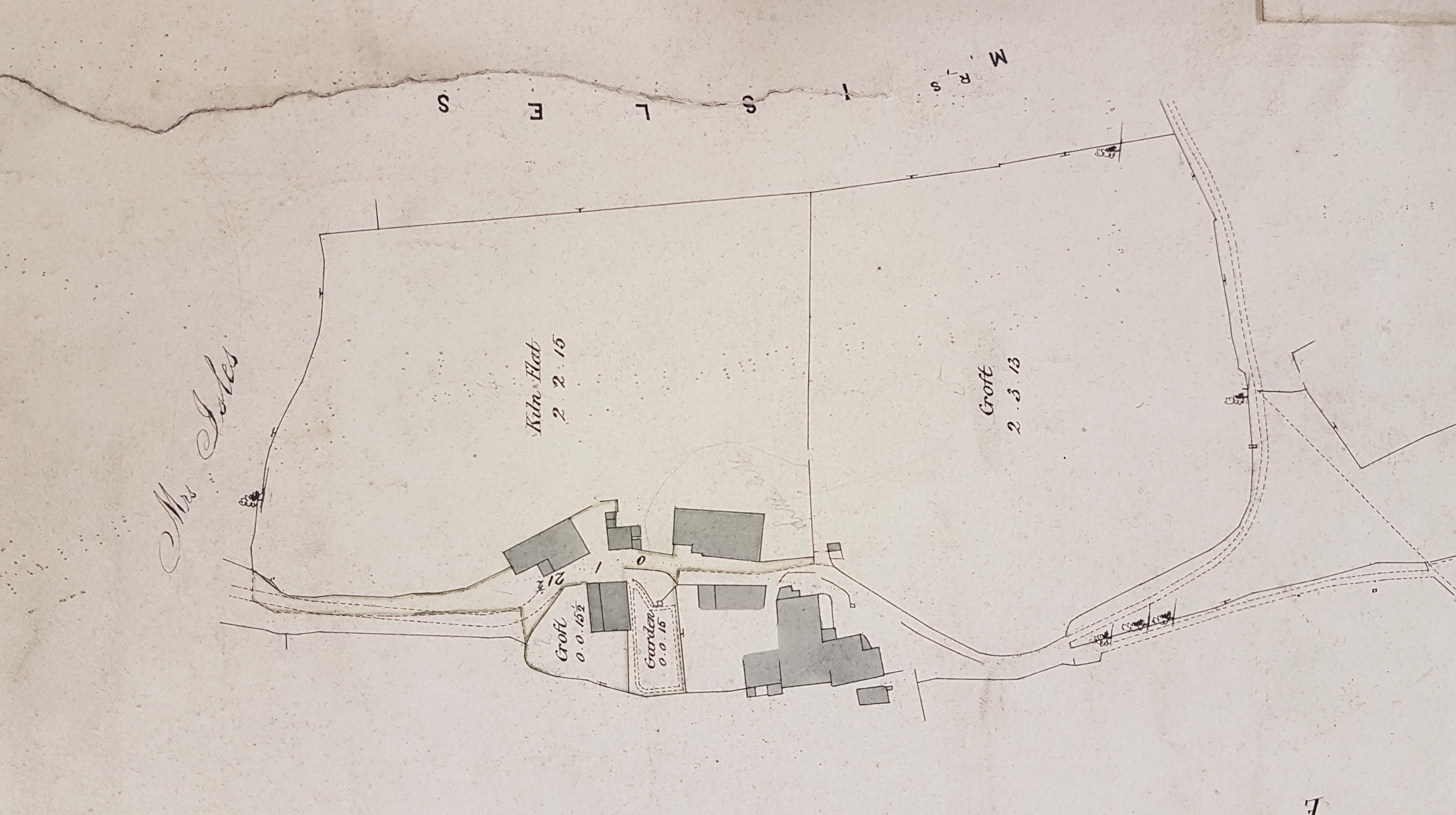
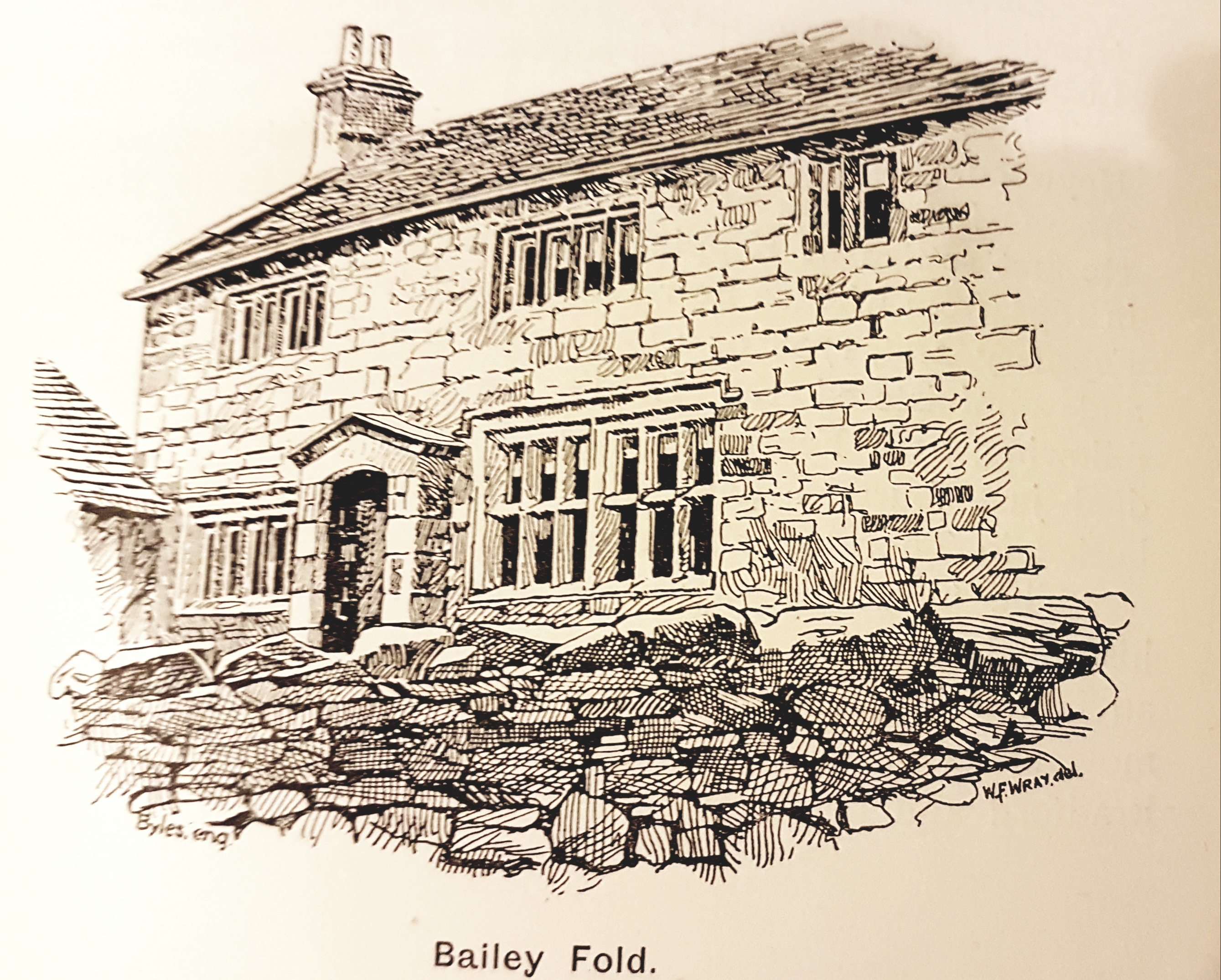
The topography of the plan closely matches that of the first Ordnance Survey map of the area which would have been surveyed in the late 1840s. The farmstead is clearly Bailey Fold, approached from Allerton village down Cote Lane. Cudworth suggests than the farmhouse was named after the original builder and that Joseph Lister, historian of the siege of Bradford, lived there in the seventeenth century. An illustration of the farmhouse is included in his history of Heaton, Manningham and Allerton although I’m not sure which of the plan buildings this represents.
On the plan, among the farm buildings, a croft and a garden are noted. The adjacent field is named as Kiln Flat. Other fields with names including the elements Ing, Royds and Holme stretch almost due south down to the Pitty Beck. The overall topography had not changed much by the early twentieth century and is perfectly recognisable from aerial images from ‘Google Earth’ as recently as 2011. Subsequent to that the buildings are present but the turf has been stripped off Kiln Flat and Croft fields for some purpose. Today the turf is restored and the pattern of boundaries, recognisable from the plan, remains substantially intact.

In this area a ‘Flat’ is normally applied to a level area of ground in an otherwise hilly situation. There are many possible types of kiln: lime, brick and malting being plausible alternatives. Ing is a common local place name element and is usually assumed to mean a meadow. Royds is equally common and was applied to a clearing in a wood. The Old Norse holme implies either an island or, more probably here, a piece of higher ground in a marshland.
As is customary on such plans as well as mentioning the owner and occupier the names of surrounding landowners are given, in this case ECL Kay and Mrs Iles. For Land Tax purposes Wilsden and Allerton are incorporated together in the early nineteenth century. These records list owners and occupiers but several of the occupiers, who are likely to be farmers, also own land on their own behalf. Cudworth describes the Cowgills as ‘an old Manningham family’. They exchanged land with Ellis Cunliffe Lister when he was consolidating his estate round Manningham Hall. William Cowgill and John Cowgill are recorded in tax records as owners of Baileyfold in the late 1820s and I believe that the two men were father and son. Joshua Robertshaw, who occupies Baileyfold, also owns land on his own behalf and was overseer and assessor for Allerton under the Poor Law Act.
ECL Kay must be Ellis Cunliffe Lister Kay of Manningham Hall (died 1854) who acquired his complex name, and a good deal of wealth, through several marriages. He began life as plain Ellis Cunliffe of Addingham being born in 1774. Ellis Cunliffe built several textile mills including Red Beck Mill, Shipley (1815) which he worked himself, and he lived initially at Calverley House. He married his cousin Ruth Myers, and combined their two surnames, in 1809 under the provisions of his father-in-law’s will. Ellis Cunliffe Lister’s second wife was Mary Ewbank, the only daughter of William Kay of Haram Grange in Cottingham. To benefit from a further legacy Ellis Cunliffe Lister then became Ellis Cunliffe Lister Kay. He eventually married for a third time. He owned much land in north Bradford and was the father of textile magnate Samuel Cunliffe Lister. The Land Tax records suggest he owned Allerton land at Swainroyd and Barleyfold too. Isles is an unusual surname, although Iles is a likely alternative spelling. In Land Tax records a man named as ‘Iles Esq’ owns land described as Goat, Moathill, Hall House and Woods all seemingly round Allerton Lanes. As yet I cannot further identify Mr. Iles or his widow, who is presumably the ‘Mrs Isles’ of the plan.
