3.026 MAN c1850 PLA BHM 821 B11
Manningham Lane: plot of land next to Spring Lodge
Paper Scale: unk Size: 55*47cm Condition: fair, small repair
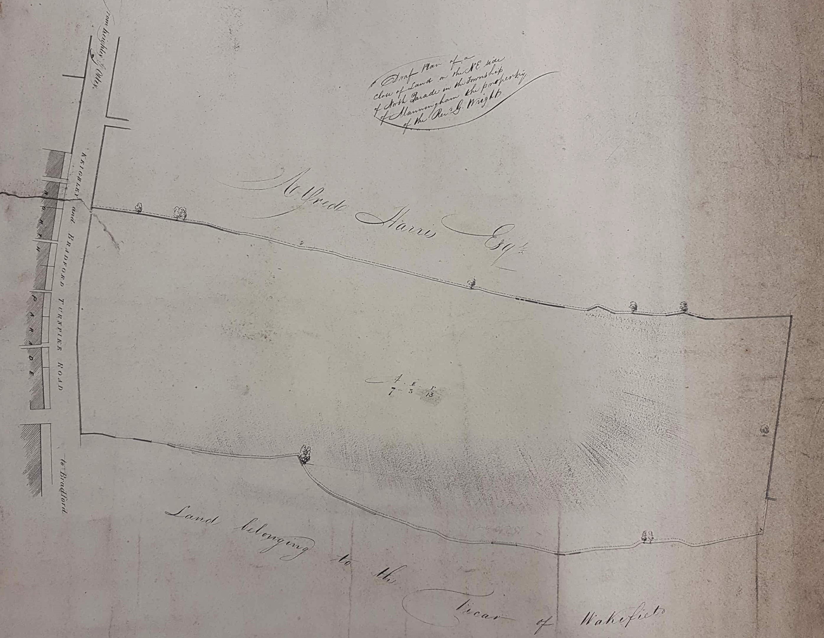
This plan is annotated on the back, but the annotation is damaged. I believe it reads ‘A 68 – Field on North Parade (belo)nging to Rev G (Wr)ight. This will certainly be the Rev Godfrey Wright of Bilham House, Hooton Pagnell, nr Doncaster (1780-1862), who features regularly on the maps I study, as a land-owner. How he may have come by his extensive Bradford property is discussed elsewhere. This particular plot of land is over 7 acres and 3 roods in area and is sandwiched between the property of the Vicar of Wakefield and that of Alfred Harris Esq.
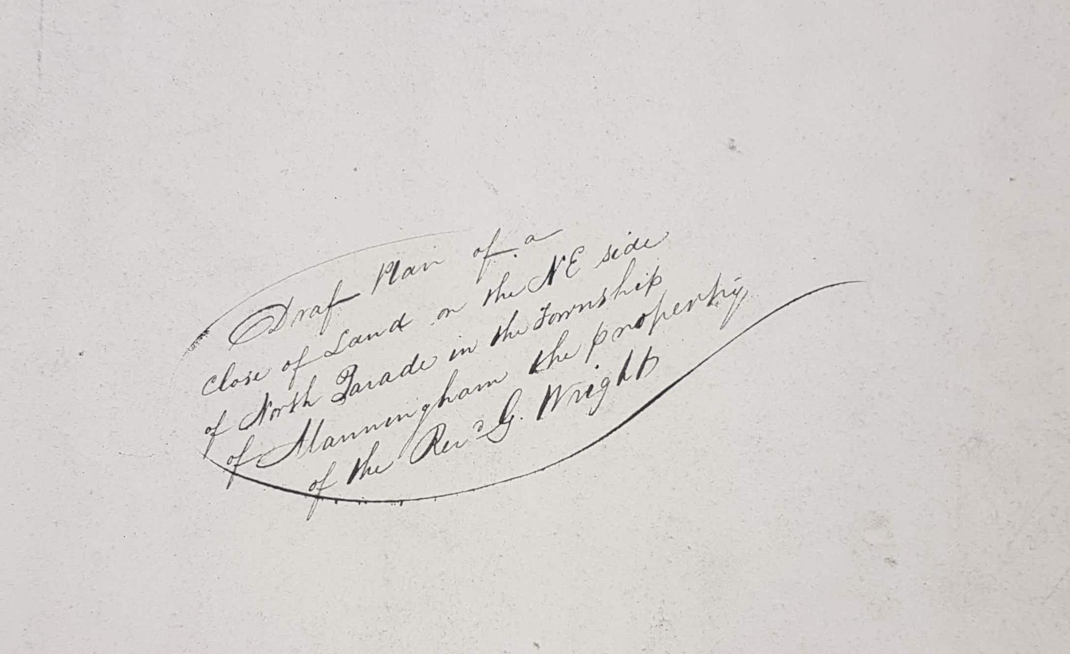
So, where are we? As you can see the map is annotated on the front: ‘draft plan of a close of land on the NE side of North Parade in the township of Manningham, the property of Rev. G.Wright.’ North Parade is easy to identify in the first OS map and the unnamed stump of road on the extreme left of the map is Drewton Street. The equally unnamed road leading off right from the upper part of the turnpike is Trafalgar Street which is still present. At the time of the first OS map in 1852 if you walked out of Bradford on the right-hand side of Manningham Lane you would pass our plot, still empty, then a plot containing Hallfield House and three cottages, next would be Trafalgar Street, then Spring Place with Spring Lodge, and and finally Holy Well. I imagine that our plot is now occupied by the Sovereign Health Care building and its car-park.
What is the date of this map? I would imagine 1840-1850. Alfred Harris (1801-1880) lived in Spring Lodge and I believe built it. Together with his brothers Henry & Charles he was a Quaker banker in Bradford managing the Bradford Old Bank. Alfred was the youngest brother and Cudworth states that he became a partner in 1824. He is resident at Spring Lodge by the 1841 census and the 1850 Bradford Trade Directory confirms that he was still at Spring Lodge a decade later. Harris is most famous for heading the development of the Bradford Fever Hospital in Leeds Road.
Hallfield House and its attendant cottages are also on the 1852 OS map. It is described as a ‘Mansion House’ when it and the cottages are advertised for sale in the Bradford Observer in 1856 and again in 1865. It is described as in occupancy by Mr C Walker and the late residence of Henry Leah (an ironmaster). It survived to become the Christian Science Reading Room.
When I first catalogued this map I thought it was quite possible that Alfred Harris acquired the plot on our plan simply to increase his garden, but now I don’t recall why I thought he might have bought it, or if indeed it was sold at all. By 1861 Harris was living in Bingley and anyone might have believed that, with the expansion of Bradford, land for speculative development was a secure investment. By the second OS map of 1889 the whole area is covered in buildings.
