Most readers will know something of the complicated story of the development of the railway service to Bradford in the nineteenth century. Any who are not familiar with the present situation should know that Bradford has two railway termini (now called Interchange and Forster Square Stations) which, though physically close together, have never been connected by track. The impossibility of through trains calling at Bradford is now generally regarded as a missed opportunity which has retarded the city’s development. I wish I knew more about West Yorkshire railway history but possibly the inclusion of this map will result in more information from a real expert.
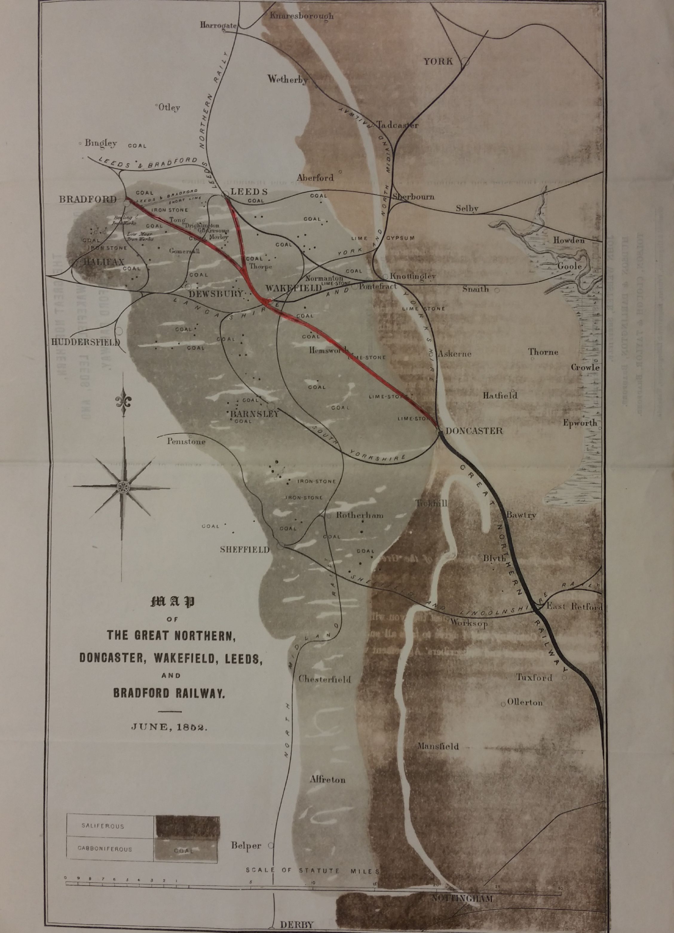
What we have here is evidently a map which once accompanied a company prospectus. A more complete account of the company can be found in the Bradford Observer 21 1852. It was called the Great Northern, Doncaster, Wakefield, Leeds & Bradford Railway and its list of provisional directors included among its number textile barons (Titus Salt and Samuel Cunliffe Lister) and present and past Bradford mayors (Samuel Smith and Robert Milligan). The directors had raised, of were seeking to raise, a very substantial capital. They had appointed as consulting engineer Sir William Cubitt (1785-1861) who was familiar with bridges, docks, canals and railways and was the chief engineer for the Crystal Palace (1851). Joseph Cubitt (1811–1872), who is also mentioned, was his son and a civil engineer.

A press report in the Leeds Mercury (14 August 1852) first describes this whole enterprise and reports that it was ‘one of two or three projects for adding to the railway communication to the town’. Clearly the stimulus was better travel to London and the south, but contact with Edinburgh and Glasgow was also mentioned. The estimated cost of the line was £625,000 – exclusive of stations – and there was to be a link with the GNR line near Doncaster. Opinions were not unanimously favourable. Even at that early stage a Mr W Murgatroyd proposed the unification of the town’s existing railway links. William Murgatroyd JP of Birks Hall was later Mayor of Bradford: he was a woolman and director of Bradford Waterworks Company and the Leeds & Bradford Railway. He died at Bankfield House, Bingley, which he had built, in 1865.
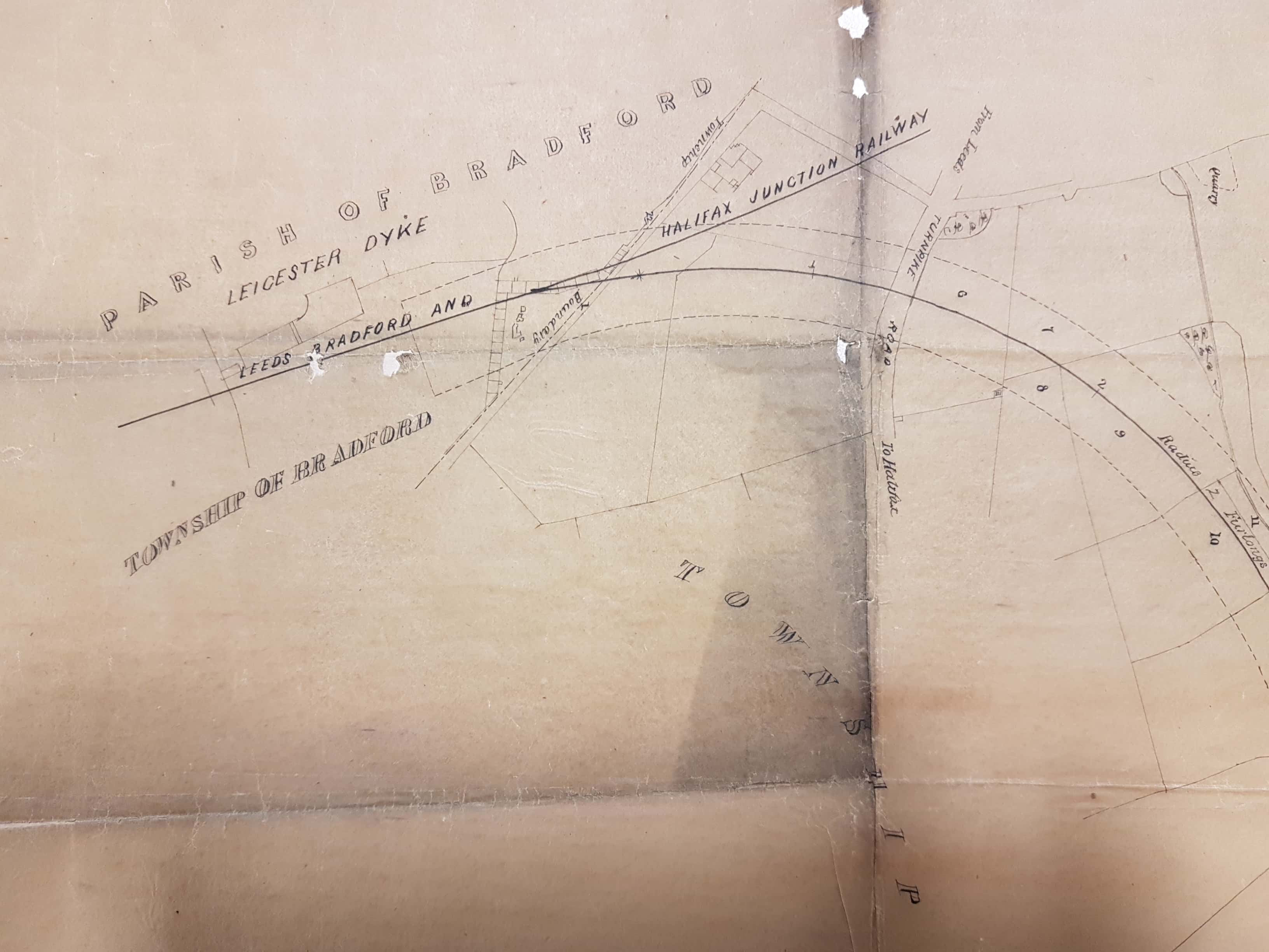
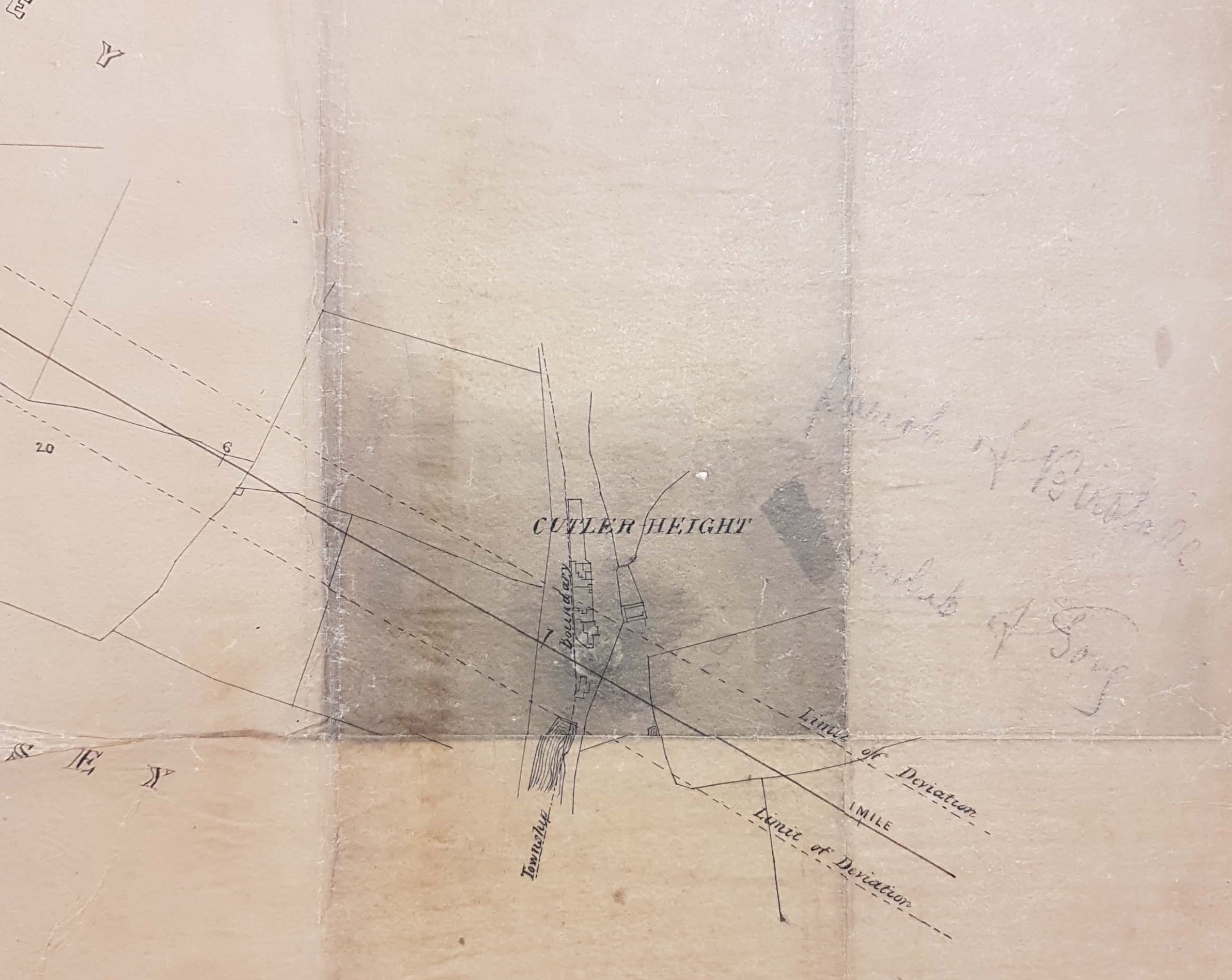
The prospectus map identified local towns and also mineral resources. Shipley is not named but the triangular arrangement of tracks round its station are unmistakable. The solitary word ‘coal’ to the left of Bingley must refer to the now largely forgotten mining of Baildon Moor. When I first saw this map I was much taken by the fact that the proposed line to Bradford linked up with the track to Shipley and so would have provided the sought after through link. Clearly then the line was not constructed as originally envisaged, and you still cannot travel direct from Bradford to Doncaster. What happened?
The map actually identifies two new links, the obvious one from Doncaster to Leeds and Bradford in red, and a much less conspicuous and uncoloured ‘Leeds & Bradford Short Line’ which connected Bowling Iron Works (actually I assume Bowling Junction) with Holbeck Junction in our sister metropolis. I assume that this was indeed constructed and is essentially the current Interchange to Leeds route via Bramley, although the sections of linking track don’t look the same as on the contemporary first Ordnance Survey map of the area. The operator is marked on the OS map as the Leeds, Bradford and Halifax Junction Railway, which after a year or two was subsumed into the Great Northern Railway (GNR).
hat about the more obvious line? There is a track through Drighlington and Tong on the first OS map but unlike the prospectus map it doesn’t head straight for Bradford but veers east at Dudley Hill Station and curves round in semicircle to join the short line at Laisterdyke. It arrived in Bradford, initially at Adolphus Street Station and later Exchange Station, but never did make the crucial connection with Shipley line. I haven’t followed the whole route but the junction of the Bradford and Leeds lines at Thorpe is also present on the OS map. I understand that the Doncaster, Wakefield, Leeds and Bradford Railway also became part of the GNR after about 15 years but I don’t know why the route was changed, and I cannot trace any press reports concerning it later than October 1852. Can anyone enlighten me?
The website Lost Railways of West Yorkshire is a very valuable resource for puzzled interpreters of maps that contain sections of railway. It can be found at:
http://www.lostrailwayswestyorkshire.co.uk/
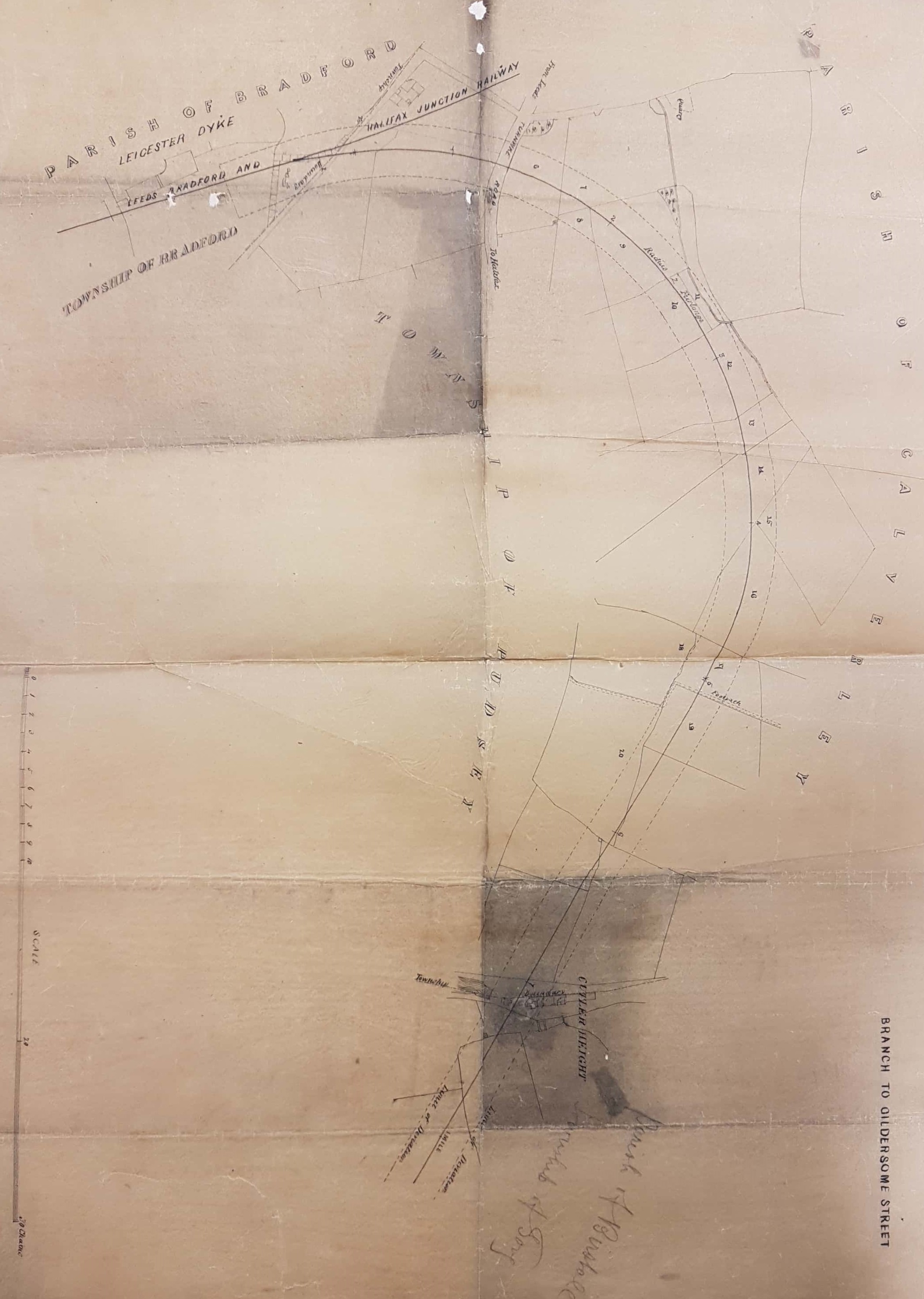
Since this plan was first published I have located a second in the Local Studies Library reserve collection which shows Laisterdyke (spelled Leicester Dyke) station mapped on the Leeds, Bradford & Halifax Junction railway (later GNR Bradford – Wakefield). This plan must be later than 1854 but I don’t have an exact date. The maps shows the land required for the Pudsey Loop (opened 1857) which was part of the line to Dudley Hill and then on to Gildersome Street, Morley, and Ardsley.