1.26 BOW c.1840 PLA BHM 562 B9
Oiled paper Scale: unk Size: 75 * 50cm Condition: Fair
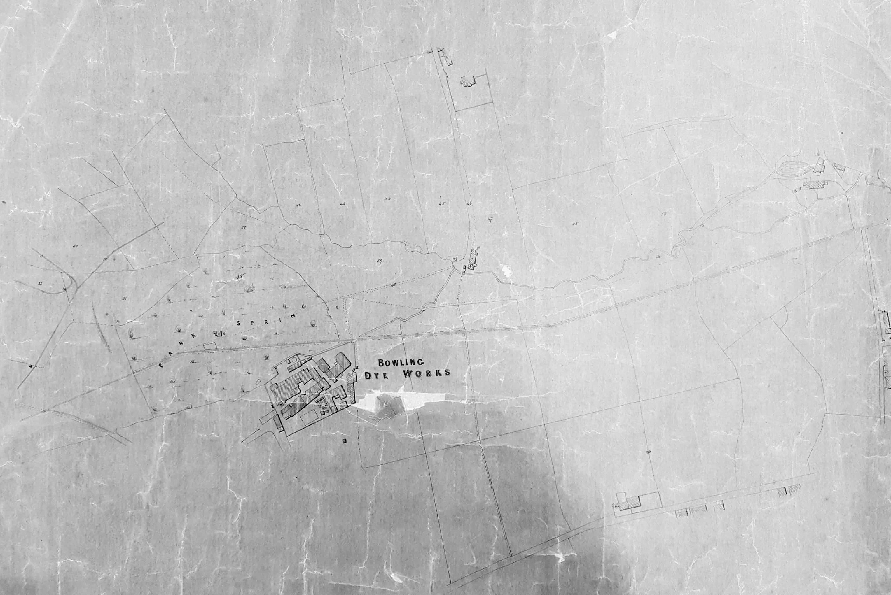
This plan is in very poor condition and the original yellow-brown background colour makes a satisfactory image hard to reproduce. It is annotated ‘tracings in connection with Messrs. Ripley’s’. Sir Henry Ripley (1813-1882), owner of the cloth dyeing concern, was among the most famous of Bradford business magnates. The new dye works had been built in 1822, but the business had been established by his grandfather in the early nineteenth century. Much later, in the 1860s, Sir Henry began the construction of model housing for workers, which became known as Ripleyville.

The top of the map is west and if rotated 90º anticlockwise it is easy to compare it with the first OS map of the area which was being surveyed in the late 1840s. The first rail track into Bradford was opened by the Leeds & Bradford (later Midland) Railway in 1846. No railway tracks are present on this plan but the extreme left, beyond the wood, was to be the future site of Bowling junction. Our plan cannot be later that the mid-1840s. Although no railway tracks are mapped the Bowling Iron Company mineral way is present. This is the straight solid double line that just clips the top of the Dye Works site and continues to the right (towards Bowling coal depot) and left (heading south) edges of the plan. Having recognised this track it is easy to spot other mineral ways along the left hand edge of the plan. These tracks moved coal and ironstone from the many local collieries to the Bowling Iron Works, and coal to depots in town. The Iron Works itself is not drawn and would be below the bottom edge of the map.
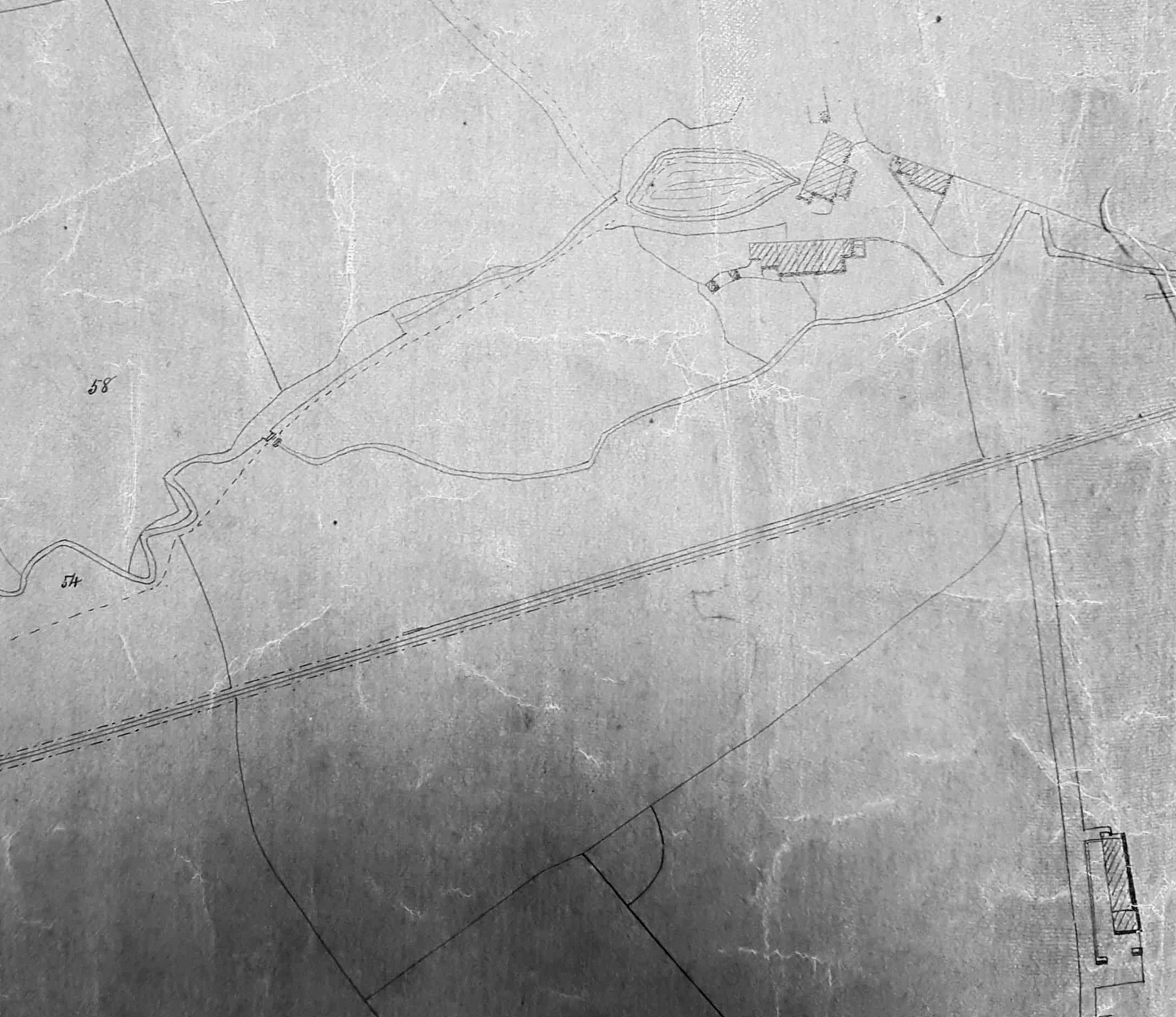
Another obvious feature ‘missing’ from this plan are the works reservoir and dye pits which were sited above and slightly to the right of the works. These are present in the 1849 Bradford map but a dye works would need a plentiful supply of water so the reservoir, at least, might well be much earlier. You can see the sinuous course of the watercourse which ends on the right with a sluice, a reservoir, and the buildings of Ivy House. At this period Ivy House seems to have been occupied by a woolstapler called Mr John Cheesebrough. It then reached the water powered corn mill known as Bowling Old Mill on Mill Lane which is not drawn. I don’t know if this beck had a specific name.
The buildings near the top right of the map are presumably Bowling House, home at this time of Mr Edwin Turner a manager at the Iron Works. The area of woodland next to the dyeworks are called Park Spring on the plan, and Spring Wood on the first OS map. The name has probably nothing to do with water. Springs are trees cut off at ground level for coppicing. At the bottom of the map is Broom Hall and some buildings along Bowling Hall Lane leading to Hall Lane Worsted Mill. The very regular filed boundaries look like the results of enclosure. The whole area was extensively mined by the time of the first OS map but evidence of this evidently didn’t interest the surveyor.
