
1.18 WIL c.1850 PLA BHM 674 B10
Cartridge paper Scale: unk Size: 48*76cm Condition: Fair
This plan shows pits at Old Allen Common. Their location is a few hundred yards beyond Wilsden Church yard on the turnpike road, beyond Ling Bob in the direction of Haworth. It is the the second plan the Bradford LS Library has of coal mining in the Wilsden area. Both surface and underground features are well illustrated. It is easy to place the pit exactly since Wilsden churchyard is included. Other surface features include buildings, ‘old pits’, quarries, boundary stones, and field boundaries. The school close to St Matthew’s Church is described as the ‘National School’ in the first OS map of the area which our plan closely resembles.
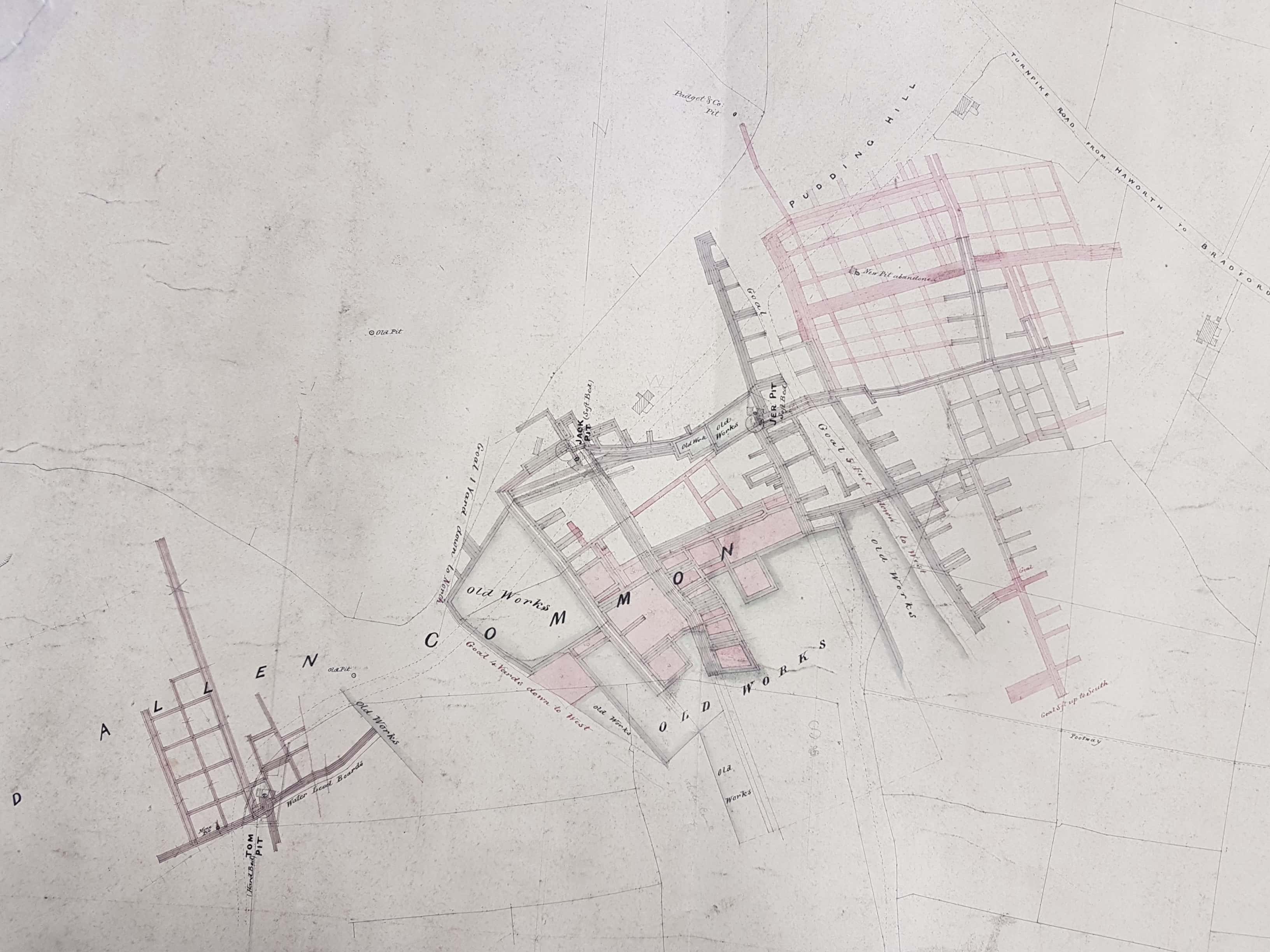
The OS map of 1852 was being surveyed in the late 1840s. Pudding Hill Colliery is well displayed this map which names one feature not named on our plan: coke kilns. Coke was a lighter fuel than coal and it would make sense to heat coal in a kiln to create a valuable fuel that would be easier to transport than the parent mineral. We can tell that the Hard and Soft Bed coal seams are being worked by the pillar and stall technique. This is a working, not an abandonment, plan. There are pencil annotations, showing the compass points for example. The West Yorkshire Archives (Bradford) have much larger maps showing mining in this whole area.
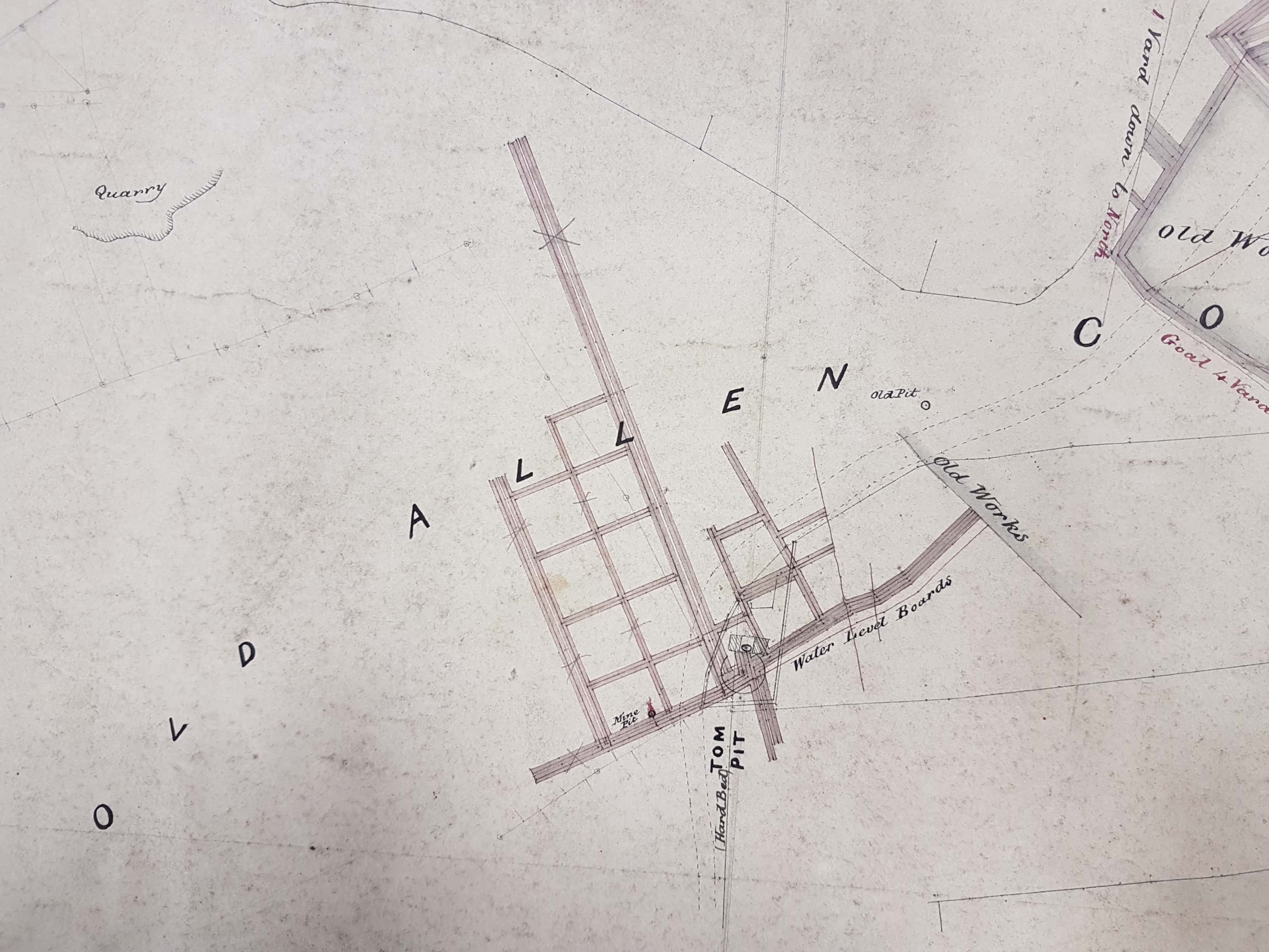
Tom Pit is a relatively small Hard Bed colliery. The main shaft is indicated by a circle but a small ‘mine pit’ is also drawn. This is marked by a splash of red which could be a drawing error but might indicate a fire. If this were so the shaft could be a ventilation shaft which might well possess a fire to draw stale air from the galleries to be replaced by fresh air moving down the main shaft. The presence of old works is indicated and ‘water level boards’. All mines had a tendency to flood. From the water level water would need to be pumped out, or drained to lower ground via a ‘sough’ or drainage adit.
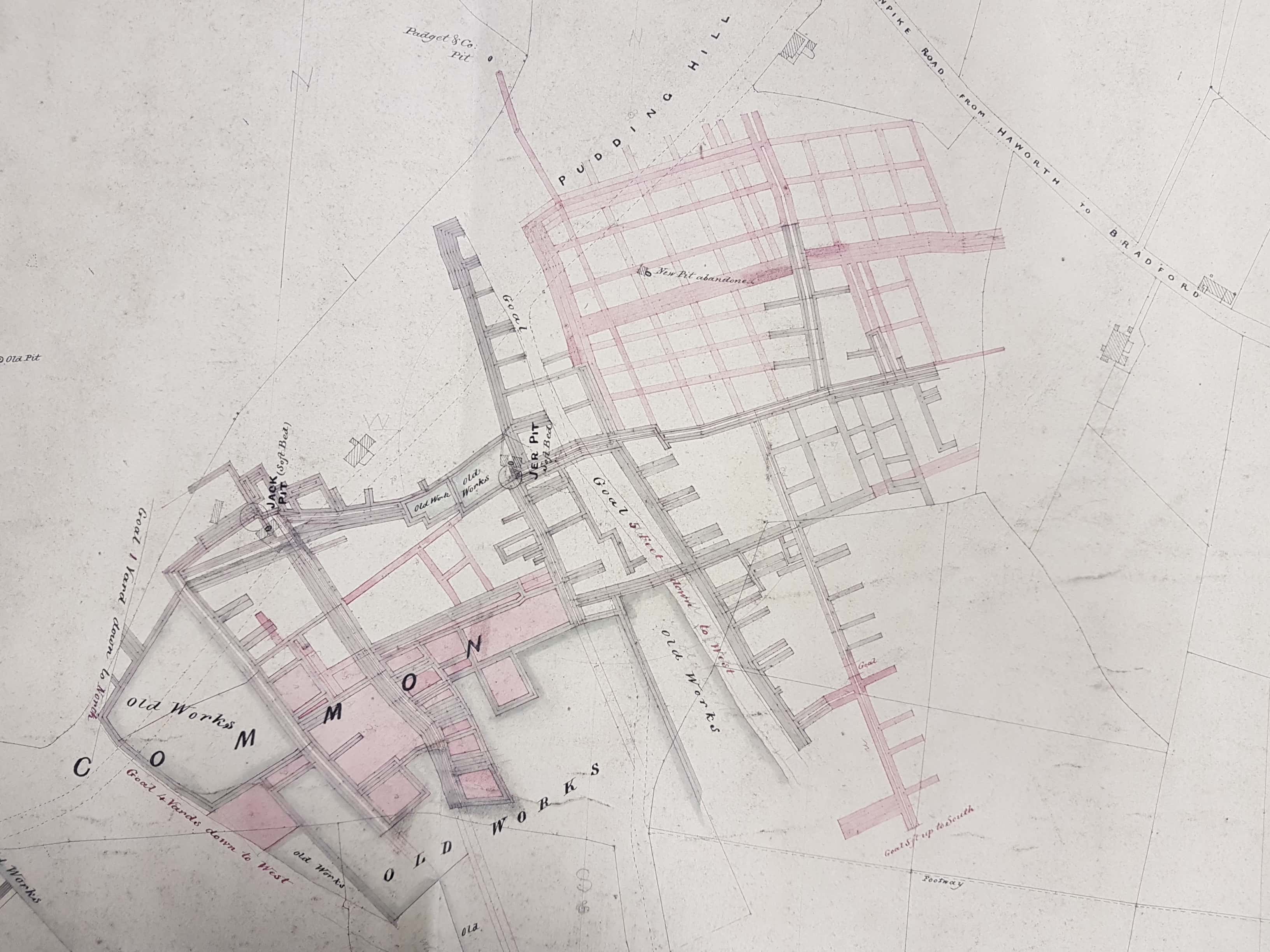
Jer Pit and Jack Pit are much larger and are accessing the Soft Bed, about 20 yards below the Hard Bed seam. In fact the Soft Bed was the deepest commercial seam in the entire Lower Coal Measures and was extensively worked in the northern part of Bradford. The quality of the coal was not particularly high and the seam was only about 2 feet thick. Extensive Old Works are again indicated and several goals, or geological faults, which could make mining very difficult. Adverse geological conditions may have accounted to the abandonment of the ‘new pit’ which is also drawn.
No ownership is indicated but an insolvency reported by the Bradford Observer on 24 June 1858 seems to indicate that Pudding Hill Colliery and a number of other local pits were then being worked by a family called Baxendall. Other Wilsden pits were called Cuckoo Pit, Corner Pit and Birks Head Pit. The Baxendalls also had an interest in coal pits at nearby Allerton. The type of gear mentioned included: a steam engine (stationary I assume), pit rails, wooden air pipe for ventilation, picks & shovels, and flags (flagstones) at the pit hill. A nearby pit is identified on the plan as being worked by Padget & Co. A gallery (pink) from Jer Pit seems to be heading off in that direction. This may be a safety precaution allowing men to escape into each other’s workings in an emergency.
Coal mining was not Pudding Hill’s only brush with fame. The Bradford Observer records Chartist meetings took place there in the 1840s. On 1 June 1848 the throng of people resulted in fear that some might be hurled down a yawning coal shaft, so we know that mining was being undertaken at that date.
