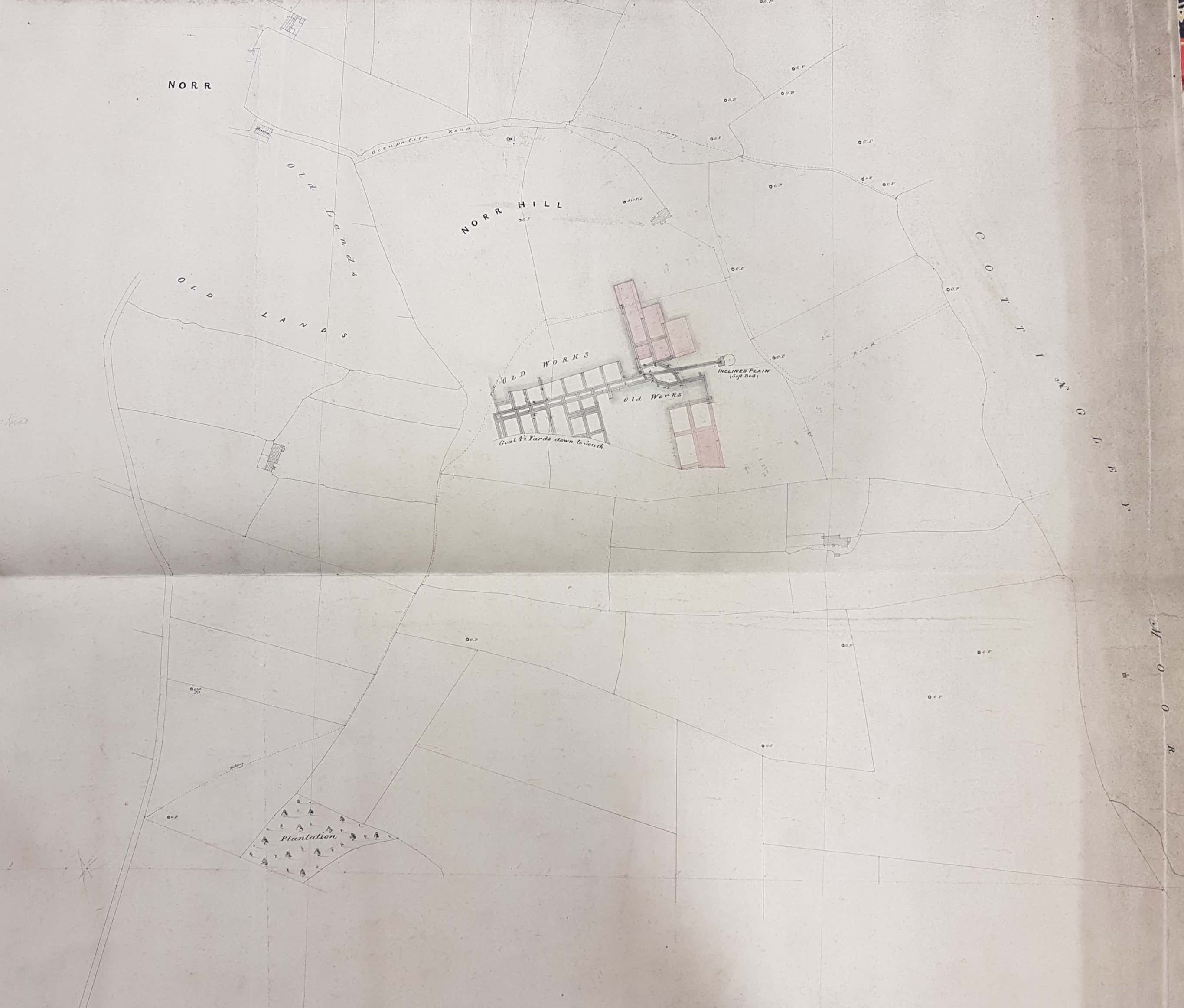
1.19 WIL c.1850 PLA BHM 675 B10 Material: Cartridge paper Scale: unk Size: 38*68 cm Condition: Good
It came as a surprise when I first learned that Wilsden was once a centre for coal-mining, but this is evidently the case even if no signs now remain. In fact collieries in this area are very well recorded with both the Local Studies Library and the West Yorkshire Archives (Bradford) having maps showing mining activity. This undated plan resembles the first Ordnance Survey map of the area and on this basis I’ve given it a provisional date of around 1850.
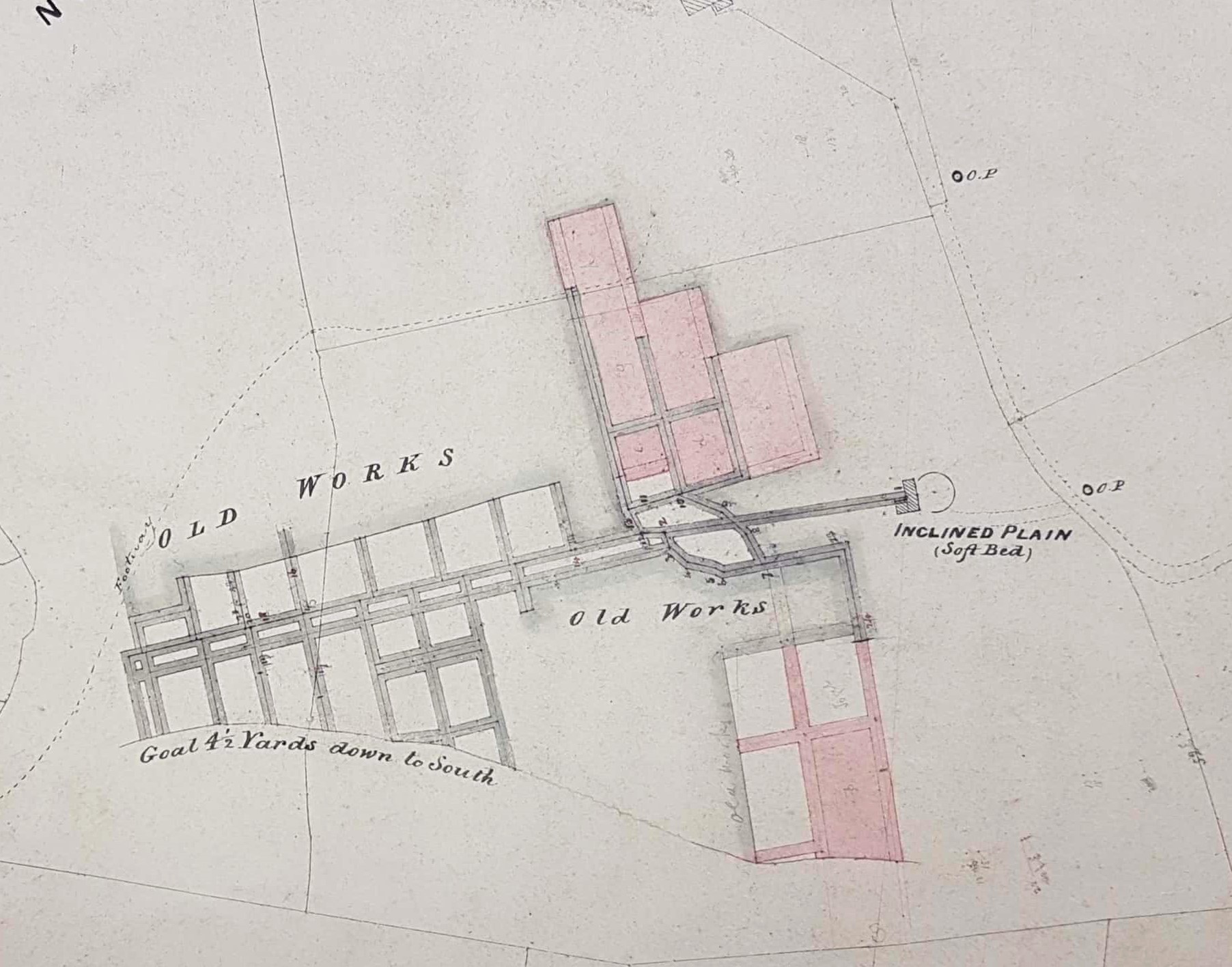
The commonest way to exploit a coal seam was through a series of shafts sunk from the surface. When the shafts reached the seam roads and galleries were dug out. As the coal was removed a series of pillars of the mineral were left to support the roof and for this reason the technique was called ‘pillar and stall’ mining. Coal cut by getters in the stalls was brought to the shaft bottom by hurriers, and then lifted up the shaft in corves, a process normally powered by human or horse muscle. A second ventilation shaft was sunk and currents of fresh air directed to the positions where miners were working.
It is apparent that the simplest way of accessing a shallow coal seam was to lift off the overburden of rock and then remove the coal mechanically. But this later technique, open-cast mining, required substantial capital investment in earth moving equipment and transport. This plan shows a third possibility which is called drift mining. It illustrates a coal seam called the Soft Bed, the deepest commercial seam in the whole Coal Measures, being accessed by inclined plane or drift dug down to meet the seam. Locally such mines were known as ‘day holes’, the day being the light you returned to after a period of arduous and dangerous work. The plan is not dated. The inclined plane is near ‘Occupation Road’ and Cottingley Woods: Norr Hill Pit is also marked. The plan shows a ‘Goal’, or geological fault, which are common in this area.
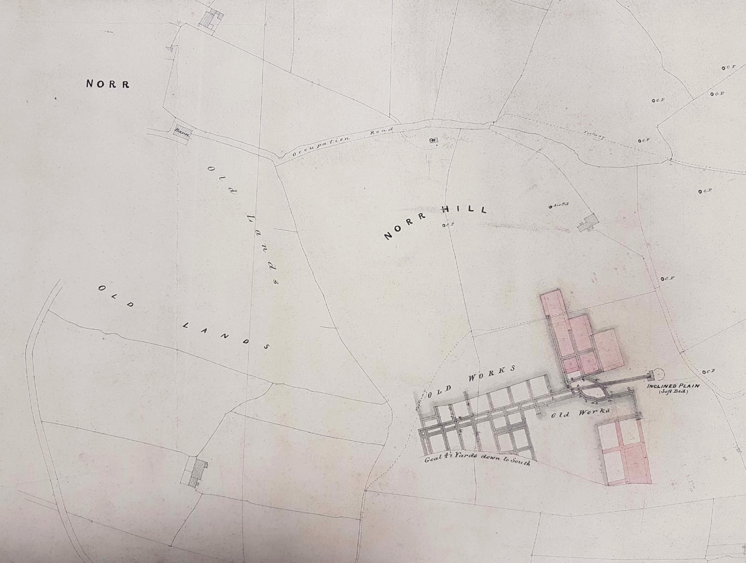
The surrounding area contains many ‘OP’s, which I assume indicates Old Pits. I’m not certain how old is old but if the plan is mid-nineteenth century then the Old Pits are likely to date from the eighteenth. Mining of this date was definitely occurring in nearby Heaton. We are looking at the remains if an industry consisting of many small enterprises requiring limited capital expenditure. No owner’s or operator’s names are indicated on what is basically a working plan. Cudworth states: ‘Coal mines (were:worked by Messrs Isaac Wood & Son, both at Norr Hill and Pudding Hill’. Cudworth also quotes Bingley register: ‘Thomas Illingworth of Cottingley, who dyed in a colepitt at Norre, with a dampe. August 1594’. This must be Bradford’s first recorded coal mining victim with a ‘dampe’ indicating exposure to a toxic gas, perhaps carbon dioxide asphyxia.
West Yorks Archives (Bradford) have large maps showing mining in the area, for example: 1251 ‘B17 Plan of new lands within the Townships of Allerton & Wilsden’. The coal belonged to ‘the late Edward Ferrand Esq’ as Lord of the Manor: he died in 1837. Thomas Dixon was the land surveyor. The Lord of the Manor had the rights to minerals under common land and, as a local land-owner, might own some locations outright.
The map shows Norr Hill & Cottingley Moor and a second mining area of Pudding Hill & Old Allen Common, south-west of the Ling Bob & Wilsden Churchyard. Some of the mining is being undertaken by a company called Padget & Co.
