![THO c.1875 SMI [index]](https://bradfordlibrariesmap.co.uk/wp-content/uploads/2018/12/tho-c-1875-smi-index.jpg)
2.55 THO c.1875 SMI BHM 1759 B27
A land sale map (Geo. B Smith, estate agents & surveyors)
Paper Scale 20 chains: 1.5 inches Size: 60 * 45 cm Condition: Poor
This map evidently identifies nine plots of land for sale in Allerton, Thornton, Clayton, Lidget Green and Great Horton. There is no indication that all the lots are under the same ownership, although this is likely I suppose. The solicitors involved are Terry & Robinson, they are known and advertised regularly in the Bradford Observer. The estate agents and surveyors are Geo.B Smith & Son. I have computer searched the Bradford Observer but this name has produced scores of hits and time prevents me from tracing this particular sale. Presumably there was once an index identifying each plot and possibly indicating the vendor or vendors. There is no indication on the map itself who the land owners might be.
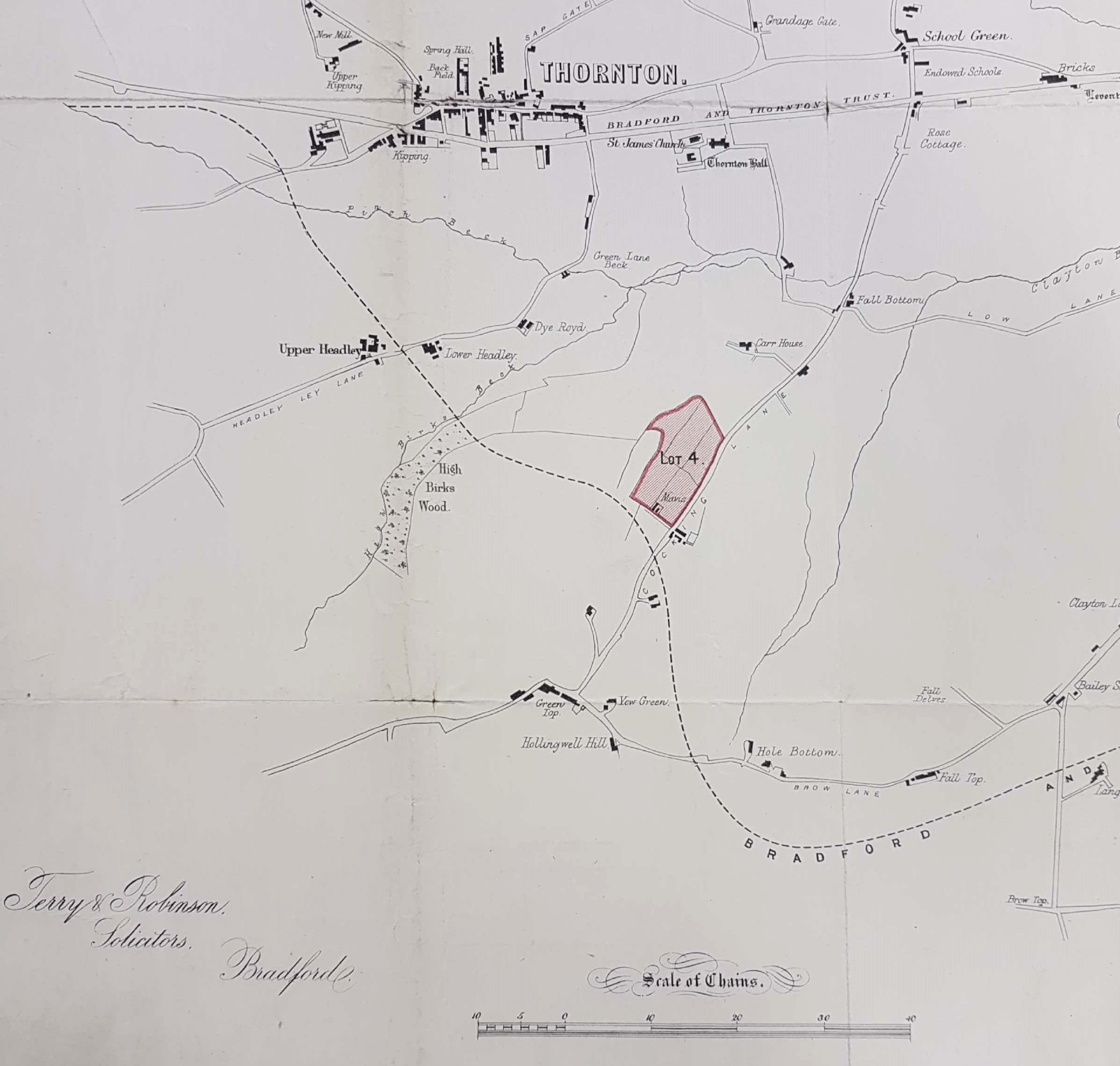
Tracing the owner of Lot 4, which had a structure called ‘Mavis’ built on it seemed plausible but was unsuccessful. Mavis, like throstle, is an old dialect name for the song thrush. The most striking feature of the map is how rural the whole area is: Thornton, Clayton, Allerton and Great Horton are no more than villages.
![THO c.1875 SMI [b]](https://bradfordlibrariesmap.co.uk/wp-content/uploads/2018/12/tho-c-1875-smi-b.jpg)
The properties mapped in Great Horton are very similar to the 1849 Bradford plan, so similar that this may have been the ultimate source. The map itself is undated and I don’t think it is possible to find a single date in which all the map’s features are correctly included. For example Hole Bottom, Brow Lane, Clayton is an empty site. After 1880 this was the site of the magnificent fire-brick works owned by Julius Whitehead. The line of the Bradford & Thornton Railway is marked so the date of this map can hardly be much earlier than 1875. The planned course of the railway makes this map of interest. St James’s Church in Thornton is what is now known as the Bell Chapel (ruin). The replacement was built in the early 1870s. Lidget Green has a ‘national school’. These schools were developed after 1811 by the National Society for Promoting Religious Education. Board Schools were the children of the 1870 Education Act and there are none present on this map. This would suggest that we probably have a map of the early 1870s. But near the National School note the name ‘Scholemoor’. If c.1875 was really the date of our map then the large Scholemoor Cemetery should should be present, and it isn’t. I conclude that this is basically the 1849 map with the railway added and the sale properties inked in.
There are several other interesting features. In Clayton there is a malt kiln. Malting barley was a necessary preliminary for the brewing of beer, which in those days was largely a local industry. Off Allerton Lane are two buildings, probably a farm, named as ‘Street Gap’. This is interesting because the name ‘street’ is so often associated with a Roman road. A Roman road crossing Bradford diagonally from Castleford to Ilkey might well arrive at this position, although this is all very speculative. In the final map note the presence of Sam’s Mill by Middle Brook. This was originally a water-powered corn mill and it is not difficult to trace back to 1800. In 1864, around the time of this map, its occupant was one James Pearson. The building remains just off Cemetery Road.
