2.99 BRA c.1850 BEC
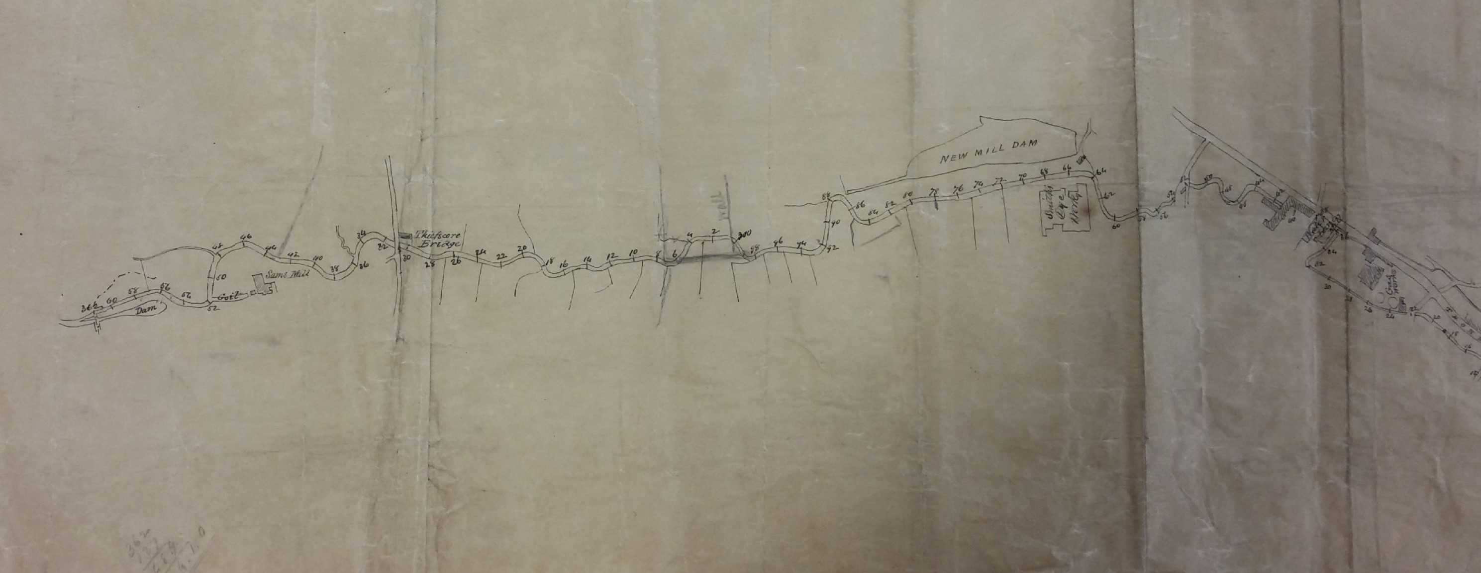
The course of the Bradford Beck through city
Material: tracing paper Scale: unk Size: 48*66 cm Condition: poor (some signs of water damage)
Today the Bradford Beck is almost completely culverted. This map plots the course of the waterway through the city in the mid-nineteenth century, indicating the significant points through which it passed. The relationships of the beck to Thornton Road and the Soke Mill goit are particularly well displayed.
The first points of interest are: Sam’s Mill (considered, with its dam and goit, to be Bradford’s oldest mill) then Thiefscore Bridge, New Mill Dam, Smith’s Dye Works, and the Water Lane Mill & Gas Works. Cudworth records that the New Mill(er) Dam was created by John Smyth of Heath, near Wakefield, around 1777. His family were associated with Miryshay off Barkerend Road. Samuel Smith, stuff dyer, is in an 1850 directory at Field Dyehouse, Thornton Road. Its moment of fame came in 1855 when distinguished local historian Harry Speight was born there, his father being the manager. The Bradford Gas Light Company had been in existence since the 1820s but the Thornton Road gas works was not constructed until 1845.
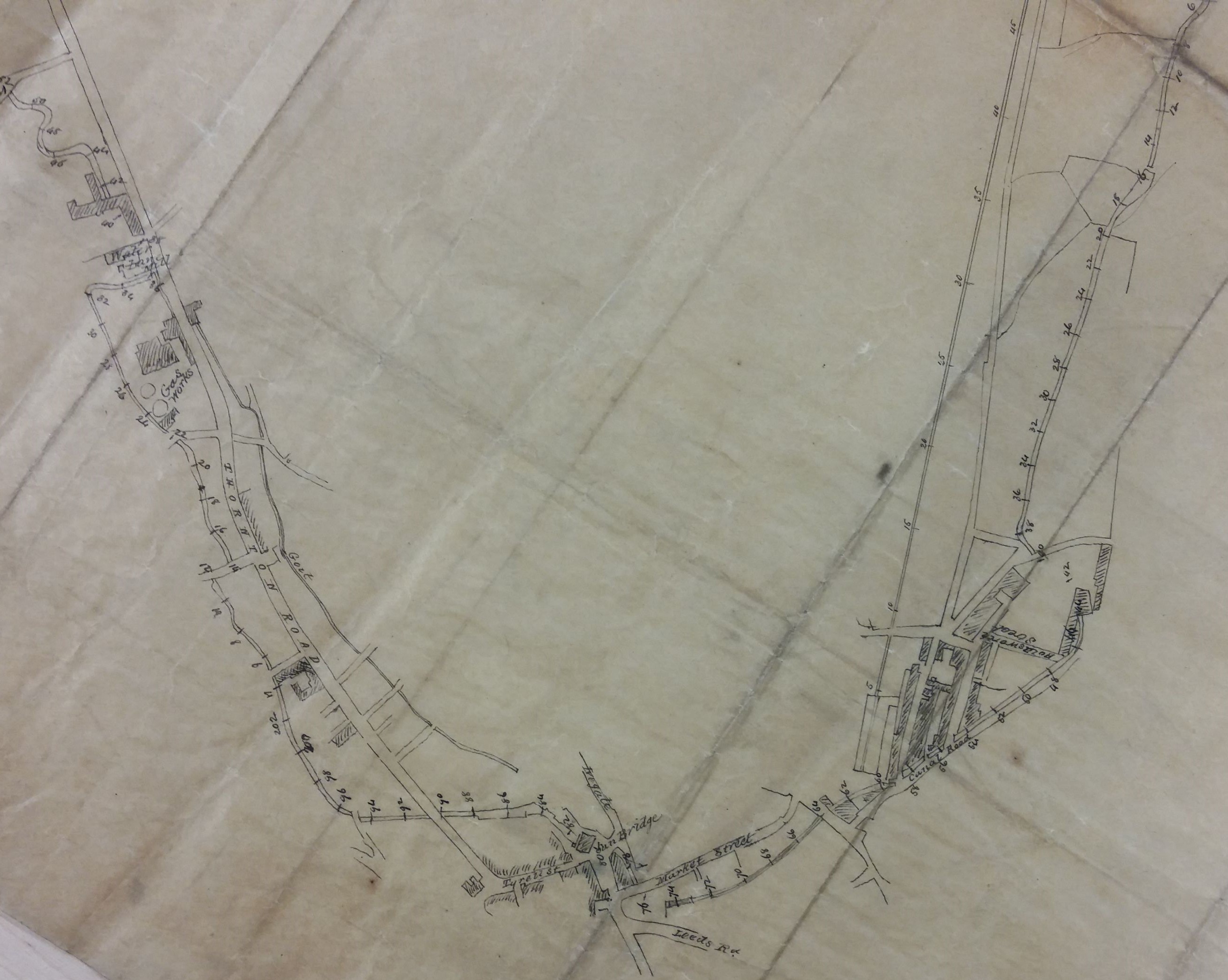
Even at this date the beck was briefly culverted under Sun Bridge but re-emerges south-east of Market Street. It was then culverted under Canal Road complex and Holdsworth Street.
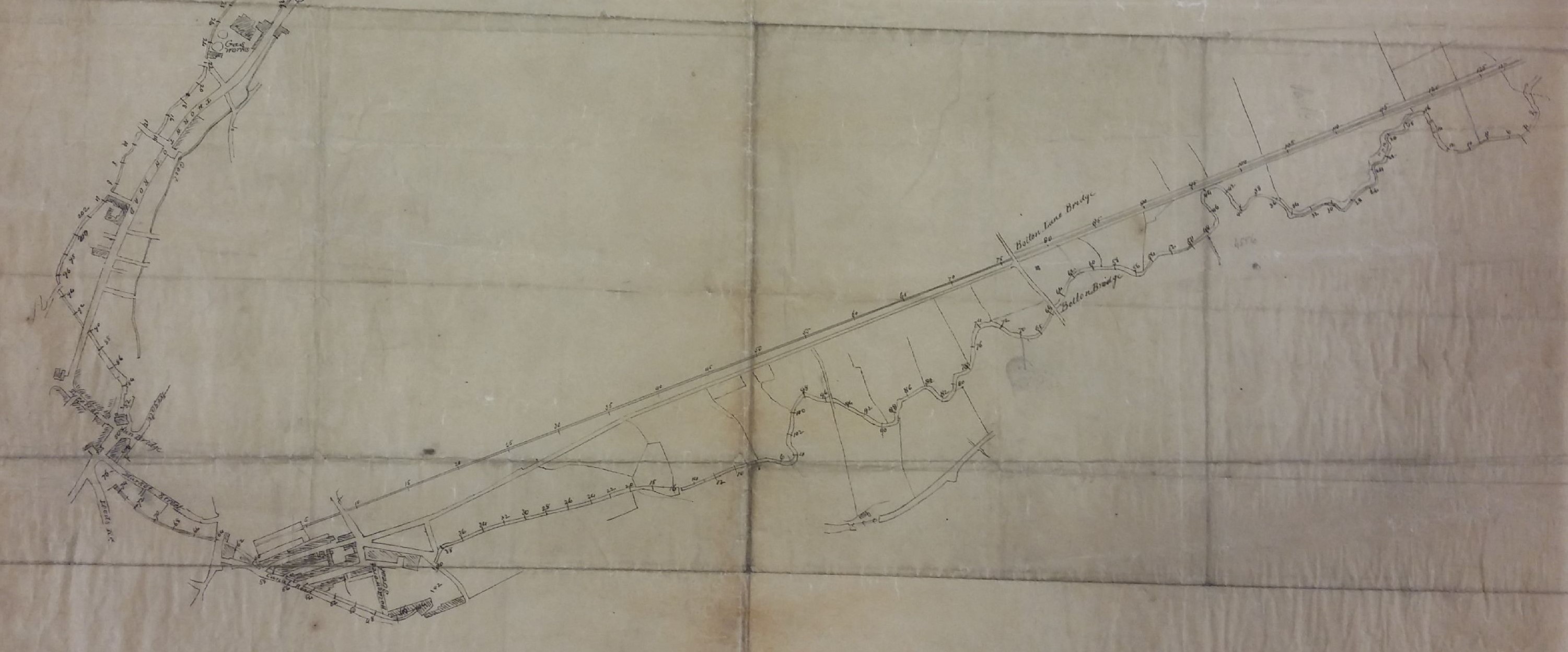
Finally the beck emerges again to pass open, and un-straightened, through Bolton Bridge and on to Shipley. Its junction with the River Aire is not shown. The map is unlabelled and undated. The Midland Station (later Forster Square) and the railway line to Shipley have been constructed, so the map must be more recent than 1846. I’ve guessed at 1850.
