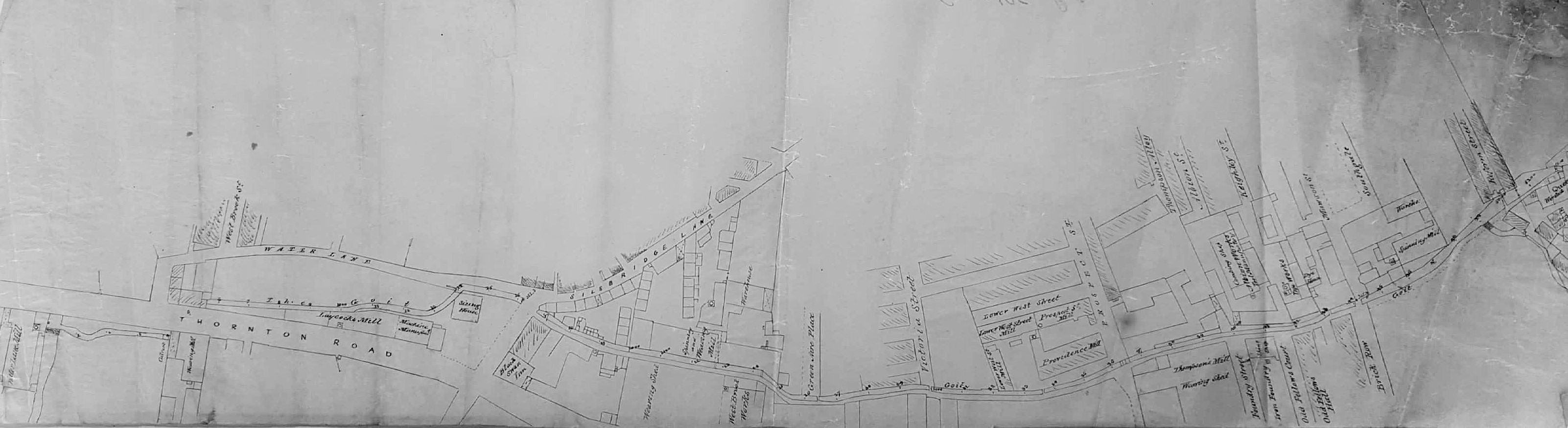
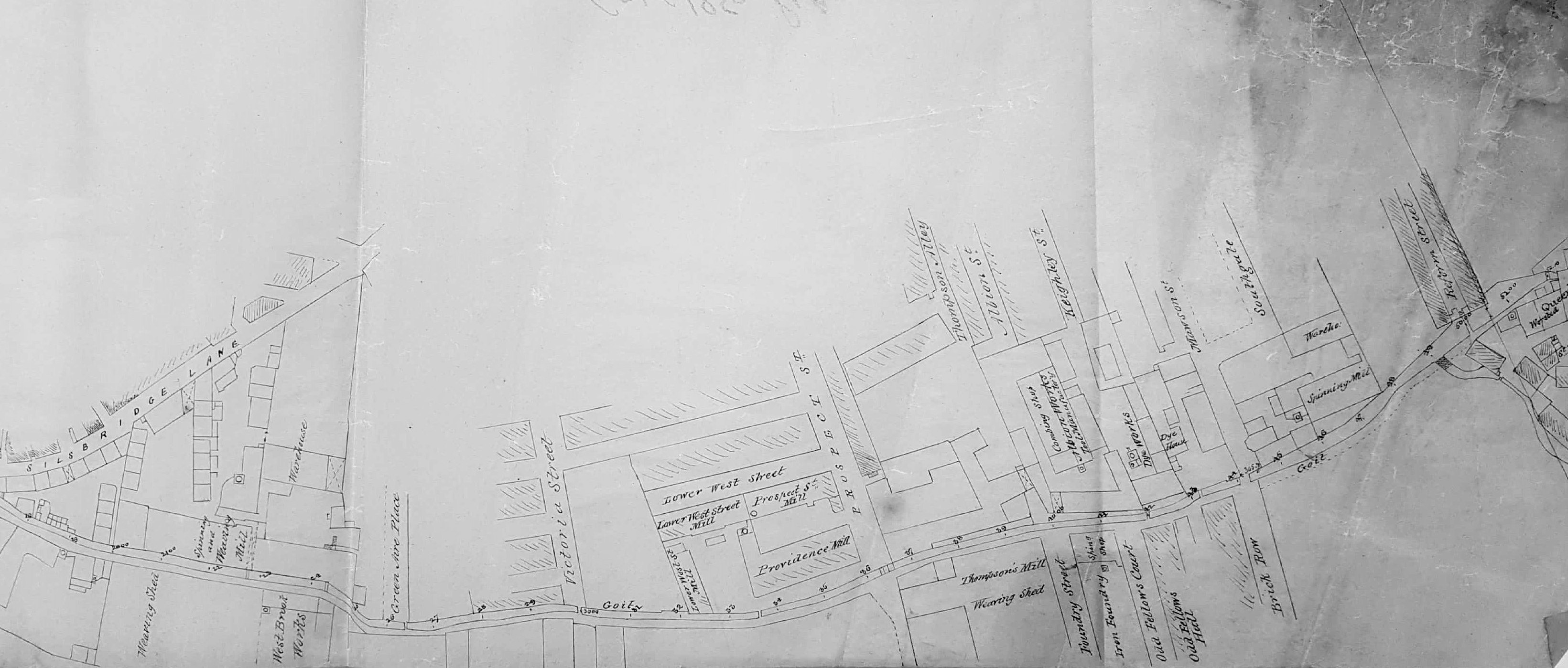
A detailed plan of Goitside in the mid-nineteenth century
2.160 GOI c1850 PLA
Water Lane Mill to Queen’s (Soke) Mill
Material: tracing paper Scale: unk Size: 70*21cm Condition: fair
Keywords: Goit, Thornton, Black Swan, Thompson, Oddfellows, 1850s
A very detailed plan of Goitside showing all road junctions and building blocks, from Water Lane Mill to the Queen’s (Soke) Corn & Worsted Mill in the Borough centre. There is no evidence of Goodwin St or Aldermanbury so, although the map is undated it can safely be taken as pre-1870. It closely resembles the 1849 Borough plan. The goit is completely uncovered and some marked units can be identified as early as the 1850 Directory eg The Black Swann (sic) Inn at 50 Thornton Road, Thompson’s Mill and the Oddfellows Hall, Thornton Road. I’ve provisionally dated the plan as c1850. Two closer views illustrate the details included here.
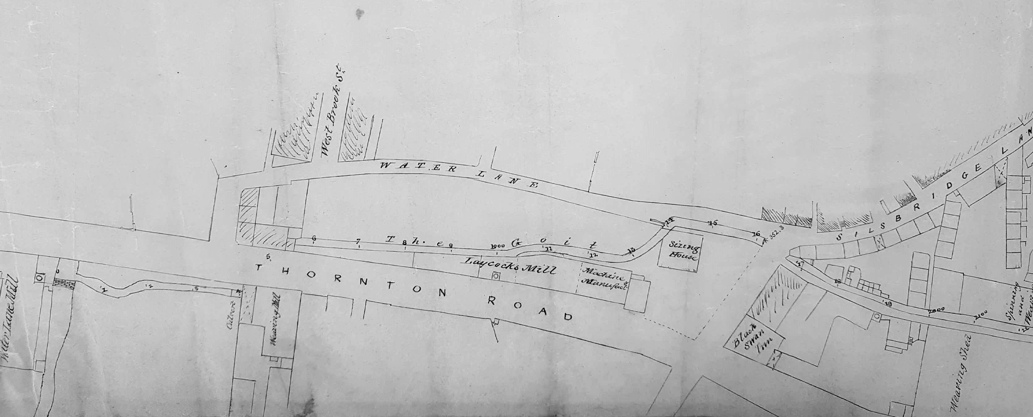

I note that going north east from Water Lane, West Grove St (the first to be built in that area and now no longer existing) is labelled as West Brook St. Is this an error on the map maker’s part?
Part of the cobbled street can still be seen at the point where it met Sunbridge Rd, by the site of the Sept 1878 murder at 58 and attack at 56. Houses north of the alley way at the side of no 56 in West Grove St were demolished around 1879 to make way for Sunbridge Rd.
The present West Brook St has a curious kink, probably due to the presence of the brook and indicating that it is a much older road than nearby streets.
LikeLike