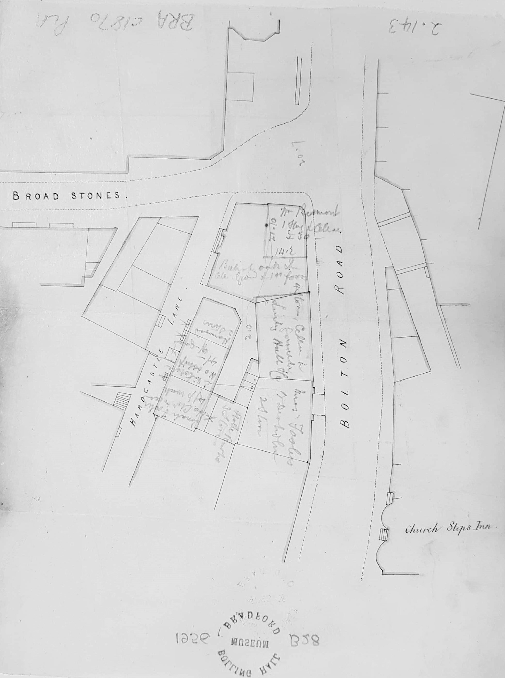
‘Cathedral steps’ in the 1860s
2.143 BRA c1861 PLA BHM 1956 B28
Broad Stones, Bolton Road intersection property map
Material: tracing paper Scale: unk 22*18cm Condition: fair
Keywords: Broad Stones, Bolton Road, Hardcastle, Inns, 1860s
This is a property map, in fine ink lines, of the Broad Stones, Bolton Road junction near the city centre. The plan has the property owners, or at least occupiers, added (not very legibly) in pencil. Of some help in dating is the Church Steps Inn, which I believe was demolished prior to the construction of Forster Square Post Office. William Scruton (whose book contains a drawing of Broadstones) says that the inn was swept away in 1882. Some building seems to have taken place since the first OS map so our plan would appear to date from 1852-82. The junction of Broadstones, Hardcastle Lane and Bolton Road is the situation of an business which (in pencil) seems to be the British Oak Inn, but I’ve totally failed to find this in trade directories. Of the other occupiers Jonah Foster, E Mitchell, Burke, & Harwood (2 stories) the only one I’m reasonably sure of is Greenwood Harwood, a whitesmith at 12 Hardcastle Lane in the 1861 Bradford Directory. On this rather tentative basis I’m dating the map as c.1861.
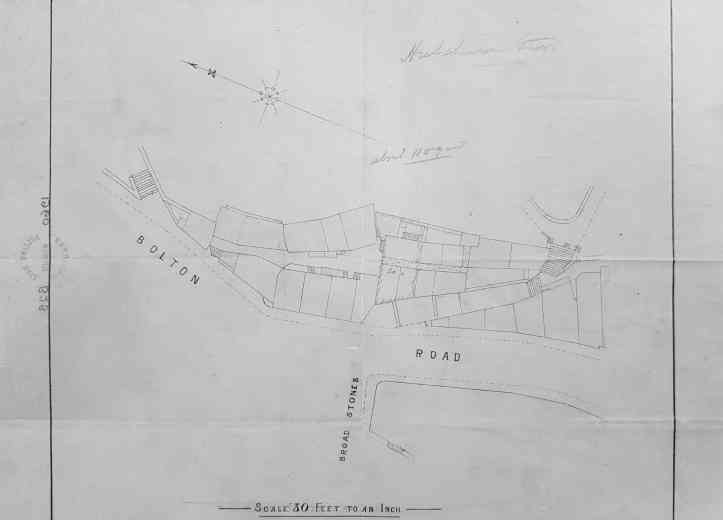
The second map (2.100) is on a different orientation but essentially shows the same junction but concentrating on the east of Bolton Road. It is also undated but annotated Hutchinsons Stars(?) in pencil. The area is immediately south of Stott Hill and west of the cathedral (then the parish church), although neither are shown the steps up to the cathedral site are mapped.
