New Mill Dam Manningham
2.124 MAN c1850 PLA BHM 1830 B28
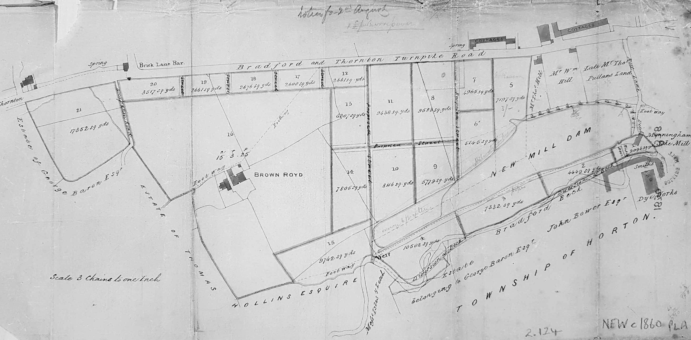
Land development between Thornton Road & New Mill Dam
Material: tracing paper Scale: 8 chains per inch Size: 42*22 cm
Condition: poor
Keywords: Mill, Dam, Manningham, Thornton, Soke, Smiths
This plan is full of information: essentially it shows the land south of the Bradford & Thornton Turnpike Road (now Thornton Road) divided up for sale and perhaps development. This road appears horizontal on the plan but in reality is slightly deflected to the north-west. The Brick Lane Bar at the top left was a place for toll collection. The toll bar is not very near Brick Lane but is located at the junction with Whetley Lane. Opposite today is the Girlington branch of Morrisons. The buildings at the top right are two rows of cottages separated by the New Mill Dam Inn. Brown Royd, Smith’s Dye Works, Manningham Soke Mill and the Bradford Beck are clearly labelled.
The map is undated. There are pencil annotations which are unhelpful. The overall distribution of buildings and field boundaries resembles the 1851 OS map including a Bradford Beck diversion which could have formed part of this scheme. Smiths Dye Works is a prominent building at the bottom right. In the OS map a dye-works of a somewhat different foot print is called Field Dye Works but we are looking at the same enterprise namely: Samuel Smith, stuff dyer, who in an 1850 trade directory was at Field Dyehouse, Thornton Road. A fire occurred at Smiths Dye Works in March 1848 (Bradford Observer) which could have accounted for some rebuilding. I have dated the plan as c1850. Cudworth records that the New Mill(er) Dam was created by John Smyth of Heath, near Wakefield, around 1777. His family were associated with Miryshay, off Barkerend Road. George Baron of Clockhouse Estate is a land-owner included on the plan, and he died in 1854. Thomas Hollins is also mentioned who is probably the man who Cudworth reports lived at West House, Toller Lane and was a stuff manufacturer, or perhaps his son of the same name.
